
Santa Maria ZIP Routing and Coverage
Five ZIP functions appear in the Santa Maria research, but their boundaries do not equal a single city outline. ZIP 93454 serves central, east, and northeast Santa Maria. ZIP 93455 covers south Santa Maria and the Orcutt area. ZIP 93458 reaches west and northwest Santa Maria and nearby fringe areas. ZIP 93456 and ZIP 93457 are ancillary routing groups that need individual address checks.
| ZIP code | Broad area served | Post-office context | Local caution |
|---|---|---|---|
| 93454 | Central, east, and northeast Santa Maria | Santa Maria delivery and post-office service | Confirm parcel and city boundary for each address |
| 93455 | South Santa Maria and Orcutt area | Orcutt/Santa Maria delivery context | Many postal Santa Maria lines are unincorporated Orcutt |
| 93458 | West and northwest Santa Maria | Santa Maria delivery context | City and nearby fringe coverage overlap |
| 93456 | Ancillary Santa Maria routing | Grouped with Santa Maria 93454 in USPS routing | 2017 routing moved from Guadalupe 93434; verify current address |
| 93457 | Ancillary south-area routing | Grouped with Santa Maria 93455 in USPS routing | Planning material historically associates it with unincorporated Orcutt |
The table is broad geography, not a ZIP polygon. USPS standardizes a preferred city and ZIP+4 for an address, while County GIS and City maps determine parcel jurisdiction. The Santa Maria ZIP code directory must keep those systems separate.
The local research did not find an official neighborhood-by-neighborhood ZIP polygon, a per-ZIP population table, or a published list of post-office station boundaries. That gap is important. A commercial map may look precise while hiding the date or source behind its boundary. For a real address, use the current USPS result and the parcel jurisdiction instead of treating a broad area label as exact.
93455 Santa Maria Mailing, Orcutt Jurisdiction
93455 is the ZIP code that most often confuses a Santa Maria search. It can carry a Santa Maria postal line even when the parcel lies in unincorporated Orcutt. Some 93455 addresses are inside the City, while others remain under Santa Barbara County administration. The postal label alone cannot select City eTRAKiT or County permit records.
For a 93455 address, first standardize the mailing line with USPS. Next, locate the parcel in County GIS and retain the APN, city or county jurisdiction, and boundary layer. Then choose City or County permits and records. A no-result from one office is not evidence that the address is false; it may be a jurisdiction mismatch.
This overlap is the defining geography lesson of the Santa Maria ZIP code directory. It also explains why a ZIP search should end with a street-level address check, not with an assumption about every person receiving mail there.
Verify a Santa Maria ZIP With USPS
USPS is the authority for the mailing line. Its city-and-state lookup accepts City, State, and ZIP Code; an address lookup accepts street address, city and state, or ZIP. Results can standardize the preferred city and ZIP+4, but they do not identify an occupant or decide whether a parcel lies inside Santa Maria.
The main Santa Maria Post Office is listed at 201 E. Battles Road, Santa Maria, CA 93454. The USPS ZIP lookup capture below illustrates the first verification step.
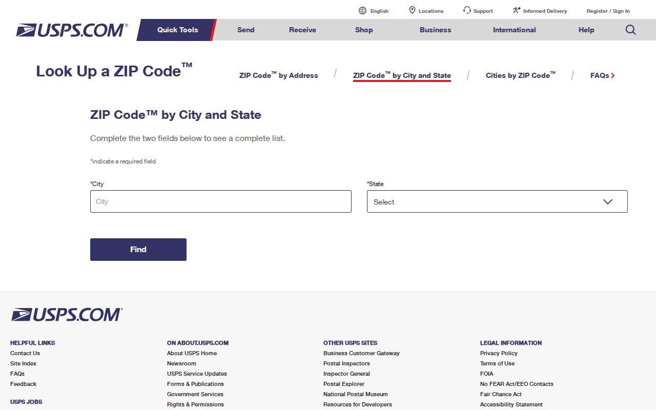
Use the preferred postal line as a starting fact, then compare the result with the County parcel and City boundary. A ZIP match can be correct for mail while still pointing to county-regulated land.
Finding Santa Maria Residents ZIP by ZIP
A ZIP-wide resident list is not supplied by the official Santa Maria portals. Use the ZIP to narrow geography, then move to a record that accepts a street, APN, parcel, name, or case number. The workflow avoids treating a mailing route as a household roll.
- Verify the address or city and ZIP with USPS. Save the standardized postal line and ZIP+4 when returned.
- Search the County Accela property lookup by address, parcel, or permit. Use the ZIP field only as one address filter, not as a resident search.
- Open the parcel in County GIS and confirm city, county, jurisdiction, APN, and boundary layers.
- Use eTRAKiT for a City parcel or address, or a County records route when the map shows unincorporated Orcutt or another county area.
- Once a ZIP narrows to a street, follow the Santa Maria street directory address chain for parcel, deed, permit, and earlier-directory evidence.
The Assessor does not offer a public ZIP filter or owner-name search. California's voter-status tool is a self-lookup rather than a ZIP-wide directory. County Elections can provide aggregate precinct or district context, subject to the state's access rules.
Santa Maria ZIP Filters in Accela
The County Accela property lookup is the identified ZIP-capable address portal. Its search type can be Address, Parcel, or Permit. Address fields include street number from and to, direction, street name, street type, city, state, ZIP, and country. Look Up and Clear controls help test a narrowed address set.
Accela is a property and permit search, not a resident directory. Use it to decide which parcel or permit route fits a postal line, then confirm the APN and jurisdiction in GIS. A result can be absent because the address falls under City eTRAKiT, because the record is not public, or because the normalized address differs from the entry.
The Santa Barbara County Accela lookup capture below shows the address controls.
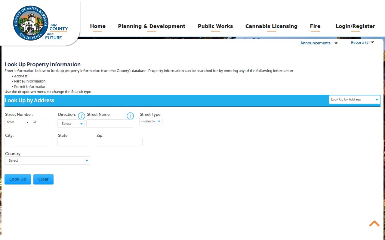
After the ZIP narrows the search, retain the exact street form, APN, permit number, and source date. Those details make a later street or resident lookup reproducible.
| Accela field | Use in a ZIP code directory workflow |
|---|---|
| Search type | Chooses Address, Parcel, or Permit as the starting record. |
| Street number range | Narrows address candidates within a ZIP or city. |
| Direction and street name | Matches the normalized road form used by the County record. |
| City, state, ZIP, country | Tests the mailing geography before parcel jurisdiction is confirmed. |
ZIP Lines Versus Santa Maria City Limits
ZIP 93455 is the central mismatch. A postal line can say Santa Maria while a parcel sits in unincorporated Orcutt. The City's planning dataset grouped 93454, 93456, and 93458 as Santa Maria and 93455 and 93457 as unincorporated Orcutt, but that is planning geography, not a permanent postal boundary. Individual parcels require current GIS or City map verification.
Annexation can move a parcel into City permit or jurisdiction systems without changing its preferred postal city. A ZIP code directory should therefore hand a confirmed street to the parcel and permit workflow, not stop at the mailing label.
- ZIP code
- A postal routing area used to sort and deliver mail; it is not a city boundary or household list.
- ZIP+4
- An added four-digit delivery segment that refines a postal address.
- PO-box ZIP
- A postal route associated with boxes or a facility rather than a particular household parcel.
- Carrier route
- A delivery sequence within a postal system, not a public resident roster.
The City civic maps and County GIS provide boundary context. The official map record should control a jurisdiction question, while USPS controls the mailing format.
When a ZIP label and a parcel description still disagree, the Santa Barbara County Surveyor map viewer adds recorded maps, APN overlays, corner records, intersection ties, Santa Maria tie-book sheets, and parcel-map layers. Those are land-description tools, not postal tools. Save the map date and the legal-description clue before asking the City or County which permit route applies.
The Surveyor viewer can clarify whether an older subdivision or corner record explains a ZIP and city mismatch. It does not certify a mailing address, so USPS remains the delivery authority.
Santa Maria Assessor ZIP Limits
The County Assessor form is designed around parcel number, house number, unit, and street name. It does not expose an owner-name field or a ZIP-wide household query. This is why a ZIP code directory cannot be built by clicking a single official “all residents” button.
Use USPS for the postal standard, Accela or eTRAKiT for the relevant permit jurisdiction, GIS for the parcel and boundary, and the Assessor for the APN and value record. When the record series is not online, a focused City or County Public Records Act request can ask for an existing nonexempt record. It cannot require an agency to create a new ZIP roster.
ZIP+4 refines delivery but does not add a public person field. A PO-box route can identify a postal facility rather than a household parcel. Even a correct ZIP and ZIP+4 should be treated as a routing answer until the address is matched to a parcel and the appropriate custodian.
Santa Maria Post Office Context
The ZIP code map also has a physical access channel. The USPS locator identifies the main Santa Maria Post Office at 201 E. Battles Road, 93454, while its online lookup verifies city, state, address, and ZIP combinations. A post-office route helps resolve mailing questions but does not disclose occupants.
The 2017 Postal Bulletin records the 93456 routing change from Guadalupe 93434 to Santa Maria 93454. Use that notice for historical routing context, then verify a current address with USPS before comparing it with a parcel, deed, directory, or permit.
Keep the lookup date with the postal result. Delivery labels, city boundaries, annexations, and permit custody can change on different schedules, so a ZIP code directory entry without a date is weaker than a dated USPS result paired with a current parcel map.
That dated pairing also makes a later correction easier because the postal and land records can be checked separately. It keeps mail routing from being mistaken for a residence record.
The Santa Maria Post Office locator result is the physical-location reference for the ZIP code directory's mailing layer.
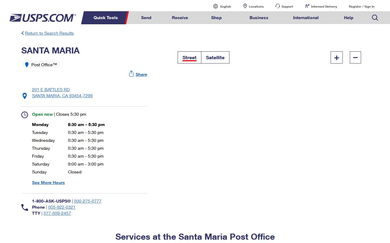
The locator confirms a postal facility, not a person or parcel occupant. Keep that distinction beside the address and boundary checks.