
Tracing a Santa Maria Street Address
A Santa Maria street directory search is strongest when it moves from a fixed address to records keyed by that address. The county Assessor supplies the parcel clue. County GIS supplies shape and jurisdiction. The Recorder supplies named parties to instruments. City eTRAKiT supplies permit and inspection context. Older reverse directories and census schedules can add listed occupants. A street result is a chain of evidence, not an automatic list of everyone at a number.
Walk the address in this order and save the source date at each stage:
- Enter the house number, unit if known, and partial street name in the Santa Barbara County Assessor lookup. Omit the suffix and try the one-letter directional form.
- Open the APN and follow the parcel to the County GIS map. Confirm the polygon, city or county jurisdiction, and any subdivision or legal-description clue.
- Search the County Recorder by party name, document type, or date. Use the instrument number and grantor or grantee role to distinguish a transfer from a lien or release.
- Search eTRAKiT by address or parcel for permits, inspections, and named project parties. Treat a party as property context, not proof of residence.
- Use library reverse directories, telephone books, newspaper microfilm, or the census for earlier occupants. Pair a listed name with an address and date before adding it to a past-household trail.
The modern street directory can show ownership signals and parcel history more readily than occupancy. California's voter-status tool is a self-check, not a public by-street search, so it cannot fill that gap.
Santa Maria Assessor Fields by Address
The County Assessor's public form is address and APN based. It exposes parcel-number and street-address fields but no public owner-name query. That design makes the search repeatable: enter the known situs, inspect the result, save the APN, and only then move to the Recorder or a lawful counter request for ownership questions.
The form says to omit suffixes such as Street, Avenue, or Boulevard and to try a partial street name. The APN example uses a three-part number with hyphens. Sort by parcel number or street to examine the result set, but do not assume numeric order equals physical adjacency for corners, multiunit parcels, or irregular subdivisions.
| Field or control | Santa Maria street-directory use |
|---|---|
| House number | Starts a situs search for a known building number. |
| Unit | Narrows a multiunit result when a unit is carried in the public parcel data. |
| Street name | Use a partial name and omit the suffix when the form requires it. |
| Parcel number | Retrieves the tax parcel directly and bridges to map and deed records. |
| Sort | Parcel number or street sorting helps browse, but it does not create a resident list. |
The result card can display situs address, APN, transfer date, document number, use description, jurisdiction, acreage, map link, exemptions, and assessed values. The public result inspected for the research did not expose an owner name or mailing address. Those fields must not be inferred from a parcel card.
Note: A situs address identifies the assessed location; it does not tell who receives mail there or who occupies it.
Santa Maria Parcels in the County GIS
GIS provides the street-browse layer that the Assessor form lacks. Open the County map, zoom until parcel outlines and labels are visible, click the target polygon, and record the APN and situs fields. Pan to parcels on both sides and across the street. If the viewer has no formal buffer tool, manual map adjacency is the defensible method. The map is informational and cannot replace a survey.
The public parcel feature service exposes OBJECTID, APN, situs street, city, state, ZIP, acreage, land use, an Assessor link, GlobalID, and created or edited metadata. It supports distance and SQL-style queries with a 2,000-record maximum, but the public schema does not expose an owner field. Use the parcel map for geography, then verify every APN in the Assessor.
The public County assessor parcel layer is the source represented below.
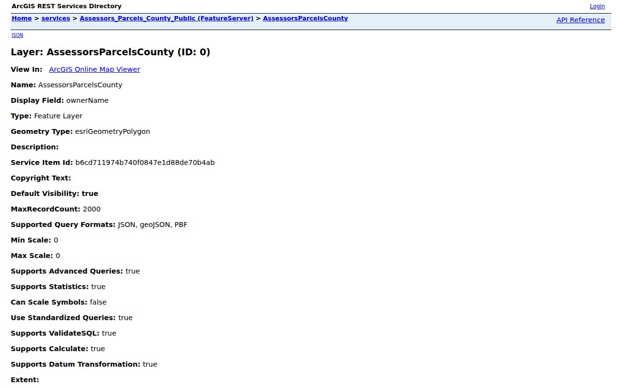
GIS can show how a street is divided, where a corner parcel sits, and which boundary layer may govern a permit. It cannot reveal a private household roster.
- Parcel
- A mapped tax unit identified by an APN; it may be split or recombined over time.
- Situs address
- The physical location assigned to the parcel for assessment purposes.
- Plat
- A recorded map showing lots, blocks, streets, or subdivision geometry.
- Criss-cross directory
- A reverse directory arranged by street and number, useful for earlier listed occupants.
One-Letter Directionals in Santa Maria
Address matching can fail for a simple formatting reason. Santa Maria eTRAKiT's guide recommends one-letter directionals such as W rather than West. The County Assessor form also expects a street-name search that may omit the suffix. Preserve the address exactly as printed, then try the normalized form accepted by the relevant portal.
When an older directory or newspaper uses another form, keep both versions in the search notes. A directional can distinguish two streets; a suffix can change a match; a unit can separate a multiunit parcel. If the record still fails, compare a subdivision plat, a County Surveyor map, a Sanborn sheet, or a newspaper notice before calling the address wrong.
The County Surveyor map search includes recorded maps, APN overlays, corner records, intersection ties, Santa Maria tie-book sheets, parcel maps, cemetery maps, and related series. Those series solve alignment questions even when they name no resident.
Santa Maria Records by Street
Address-keyed records answer different parts of a street question. The Santa Maria street directory works best as a linked set: parcel to map, parcel to permit, named party to deed, and older address to directory or census. The table keeps the access route and the limit visible.
| Address record | Keeper | What it can show | How to reach it |
|---|---|---|---|
| Assessor parcel | Santa Barbara County Assessor | APN, situs, value, use, transfer, and map data | Free address/APN web lookup |
| GIS parcel layer | Santa Barbara County GIS | Adjacent polygons, boundaries, acreage, and land-use fields | Interactive map and public feature service |
| Recorded deeds and liens | County Clerk-Recorder | Grantor, grantee, instrument, date, and legal-description trail | Index online; image, copy, or counter route |
| City permits | Santa Maria Community Development | Permit, inspection, address, applicant, contractor, and owner context | Public eTRAKiT search; request for files |
| Earlier occupants | Santa Maria Public Library | Listed adult, subscriber, street entry, obituary, or chronology | Special Collections, microfilm, reference service |
| Election material | County Elections and California SOS | Precinct or district totals, plus the voter's own status | Aggregate results or restricted approved request |
Use the APN as the bridge between map and Recorder. Use the street name as an index term only after normalizing directionals and suffixes. A parcel record does not establish occupancy, and a directory entry does not establish title.
Santa Maria Deed Chain by Street
The Recorder's index is the strongest address-adjacent ownership trail. Search the current relevant name, narrow by recording date and document type, and note the instrument number. In the advanced mode, separate grantor and grantee roles. The person receiving the property in one deed may be the person conveying it in the next search backward.
Try `LAST FIRST` syntax, surname plus first initial, exact organization names, and the portal's sounds-like, wildcard, exclusion, fuzzy, proximity, and quoted-phrase operators when the name is compound or the index spelling is uncertain. Trust transfers, interspousal deeds, mergers, parcel splits, and reconveyances can create a gap that is not a missing household.
Recorded-document coverage is divided into after-1975 online records, the 1931-1974 historical index, and older archival material. The County's advanced Recorder search exposes name, dates, grantor, grantee, document types, document number, and map-book/page modes. When the online route stops, use the historical index, book and page references, a counter request, or the County's archive holdings.
Note: A deed chain follows title holders and recorded parties, not every occupant, relative, or household member at the address.
Santa Maria Permits by Address
eTRAKiT adds a dated project trail to the Santa Maria street directory. A public search can return a permit number, status, inspection events, applicant, contractor, and owner context connected to an address or parcel. The guide says applications must connect to a valid city parcel or address, and it recommends the abbreviated directional format. Owner information can prepopulate from the County Assessor and may lag a recent transfer.
Permit parties are evidence of a project relationship. They may be a former owner, contractor, agent, applicant, or other participant. They do not prove that a person lived at the address. Inspection status is updated daily by 8 a.m. and the system can schedule up to seven days ahead with daily caps. For plan sets or nonpublic detail, request the existing record from the City and account for copyright or authorization limits.
The city portal also supports public accounts for searches and applications, while professional accounts serve contractors and design professionals. Keep the permit number, status date, and address together when comparing the result with a deed or directory entry. The official eTRAKiT guide supplies the city's field and workflow instructions.
Reverse Directories for Santa Maria Streets
Modern property rolls are poor at showing earlier non-owner occupants. The Santa Maria Public Library's Special Collections holds city directories and telephone books, while the regional newspaper microfilm begins in 1882. A reverse or criss-cross section reorders a volume by street and house number. That layout can locate a listed adult when the alphabetical name section is hard to search or when the surname is unknown.
Read the volume's abbreviation key first. Common fields can include a name and initial, spouse in parentheses, occupation, business affiliation, `h` for house or residence, `r` for roomer or resides, a widow notation, address, and occupancy marks. The exact Santa Maria publisher and year run is not published online, so ask the library to confirm the issue before promising continuity.
Pair the reverse entry with a census year, an obituary, a newspaper notice, a deed, or a permit. A directory may list a subscriber or adult at a date; it does not prove that every person in the building was recorded.
The historical collection itself belongs to the Santa Maria city directory page, while the modern APN and deed chain remain the street directory's work.
When Santa Maria Mail Leaves City Limits
ZIP 93455 is the key Santa Maria boundary trap. Many addresses use Santa Maria as the postal city while the parcel lies in unincorporated Orcutt. ZIP 93454, 93456, and 93458 also need address-by-address verification, and 93457 has its own south-area routing context. A postal city is not a municipal boundary.
Run a jurisdiction check before expecting eTRAKiT to return a permit. Confirm the standardized postal line with USPS, click the parcel in County GIS, compare the official City boundary or annexation map, and then choose City or County records. Annexation can move permit custody without changing the preferred postal city.
The City's civic maps and the County GIS layers help separate city limits, council or election geography, and mailing geography. This step prevents a false negative when the address is real but the wrong agency holds the record.
Santa Maria Street Directory Limits
No official Santa Maria street directory exposes every household. Unlisted residents, private utility accounts, DMV addresses protected by the federal Driver's Privacy Protection Act, Safe at Home addresses, and ballot choices remain outside the ordinary street chain. Community pages may name a public contact, but a private member roster cannot be inferred.
California voter data is governed by Elections Code sections 2180 through 2194. The state's self-service form authenticates one voter. A permitted file request requires a declared purpose, requester information, and the official application. A mismatch can reflect a name, date, address, or registration-maintenance issue rather than absence from Santa Maria.
Lawful use. Use address and parcel records for personal, lawful research, family history, property curiosity, or civic work. Do not use a result to stalk, harass, intimidate, threaten, impersonate, or defeat a protected address.